|
Project:
Identification of Location of
Buried USTs |
Electromagnetic Survey To Determine Location of USTs SAF
Grant # 454767-68 |
|
DESCRIPTION:

|
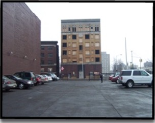
Purpose of study was to
determine if USTs were located in the ground on the site. Survey
was performed over a 450 ft x 225ft area located south of
Francis Street, between Eleventh and Twelfth Streets in Ecorse,
MI. Collected EM data
with an EM61 High Sensitivity Metal Detector and recorded it by
an integrated data logger (Polycoder 600) with two channel
information. Subsequently transferred data to an in-office desk
top PC computer for processing and interpretation. Performed
mapping programs using subsequent processing and
interpretation. Presented data in two basic forms: contour maps
and linear profile. Plotted profile form data with a 0 to 2000
millivolt (mV) vertical scale to present a common scale to
provide uniformity in the data presentation. Examined profile
forms/graphs to reveal anomalies. Found two large anomalies
that appeared in suspect locations of historically buried USTs.
Prepared report. Completed project within time and budgetary
constraints. |
|
Duration:
|
2 Months |
Completed Projects:
•
Remediation Project •
Environmental Site Assesment •
UST Removal •
System Design •
Site Closure •
Baseline Environmental Assessment •
UST Release Closure •
Removal of Unregulated tanks •
Legal Involvement •
UST Involvement •
Subsurface Investigation •
Oversight Management •
Subsurface Investigation •
LUST Closure •
Subsurface Investigation •
Super Fund Project •
Site Assessment •
UST Removal •
UST Involvement •
Baseline Environmental Assessment •
UST Involvement •
Consulting Institutional Controls •
Subsurface Investigation •
Sampling •
Identification of Location of UST •
UST Release Closure •
UST Closure •
Removal Oversight •
Site Closure •
Environmental Site Assessment •
Phase I ESA •
ESA for a Marina •
Limited Subsurface Investigation •
Residential Apartment Complex •
REC Evaluations •
Bulk/Commercial Fueling Station |